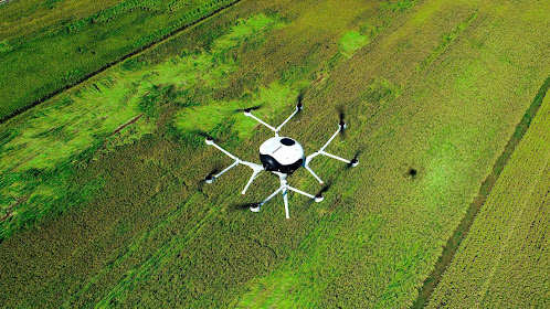
Tips to do the Perfect Drone Survey
The accuracy of drone
survey mapping is significantly influenced by the performance and kind of
drone, the quality of its components, the camera resolution, the height at
which the drone flies, the vegetation, and the method and technology used to
geolocate the aerial photos. With a high-end surveying drone, absolute
precision down to 1 cm (0.4 in) and 0.7 cm/px (0.3 in/px) GSD may now be
achieved under ideal conditions. Make sure to look for the best DroneService Providers.

A Guide to Drone
Survey
- Check before you leave the
office
Check local
legislation to ensure that you are permitted to fly your drone where you intend
to. Also, make sure the weather is appropriate, which means no rain, fog, snow,
or strong winds. Check that your drone's battery and any linked gadgets, such
as tablets, are completely charged, and that your drone camera's memory card
has enough free space to shoot the entire project.
- Plan your flight
The drone flight
planning program on the tablet can be used to build the survey flight plan.
Simply tap and drag the points around the region you wish to survey, or import
a KML file to accomplish this. Make remember to account for tall objects and
altitude changes in your flying plan.
- Fly and collect images
After pressing the
take-off button, the drone takes off, gathers photographs, then returns to its
original location. The operator simply ensures that no one approaches the drone
during take-off or landing and that the weather conditions remain ideal for the
survey mission, in this step. Make sure to look for the best Commercial
Drone Photography services to experience the difference.
So, keep these drone
survey tips in mind before you finalize your Commercial DroneServices. We offer top-notch services at an affordable rate.
Comments
Post a Comment